|
|||||||
|
|
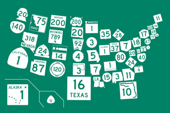
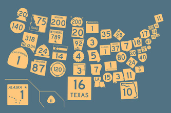
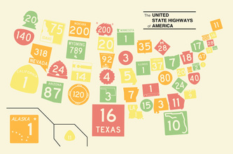
The United State Highways of AmericaA map of 50 states and the District of Columbia created with state highway markers.
[click to enlarge]
Prints available at Society6.com/StonebrownDesign. The standard sign for a state highway, according to the Manual on Uniform Traffic Control Devices, is a simple circle with a number in it. Fortunately, states are free to create their own markers, and many opt for something unique. One common approach is to use the outline of the state around the route number, which quickly identifies the road as a state highway. It also raises the question--what happens when you put those state-shaped signs together into a map? That map of route markers has plenty of states that don't look like states at all. While many mark their highways with the standard circle or variations on a rectangle, others have turned the route marker a creative state symbol. Utah's marker is a beehive. Kansas uses a sunflower. You'll find profile portraits on the Washington, North Dakota, and New Hampshire markers. Nebraska and Wyoming use icons of classic Western scenes. Can you guess which state uses a sign that looks like a keystone, or a wedge of cheese? (Okay, I might be just imagining that last one.) When they're all put together in a map, the state highway markers make a unique composite portrait of America's state identities. (And in case you're wondering, the route number shown is that state's longest state highway.) This state map of roads makes a perfect companion to my road map of states. Art prints now available at Society6. These high-quality digital prints are produced on acid-free cotton paper with archival inks. Available in several sizes: 7" x 10", 13" x 18", 17" x 23", 20" x 28", and 28" x 40". (Society6 prints with a white border, so you can trim to fit a frame if needed.)
For aesthetic reasons, this graphic eliminates the distinct colors several states use (sorry, Vermont and Minnesota). But the good news is that the map is available in four unique colors: Interstate Green, Slate Blue, Rust, and Classic Map (matching the United Streets print). See more maps.
|
||||||
|
|
|||||||


